
Franklin Neighbors by Official Source
There is no public Franklin roster of everyone around an address. A block check joins several narrow records: parcel geometry identifies the nearby land, the assessor supplies an ownership and mailing clue, deeds establish a legal party and date, and civic or planning sources add limited community context. Start with a source that explains the question being asked. A map label is not a current resident, and a person linked to an address in one record may hold a different role in another.
| Source | What It Shows About a Block | Access |
|---|---|---|
| City GIS address and parcel layers | Address points, parcel geometry, buildings, streets, and adjacent parcel IDs | Public map or REST service; 2,000-result and selection limit |
| Williamson County assessor | Owner, situs, mailing, parcel, and sale clues for an individual parcel | Free public search; owner is not every occupant |
| Register of Deeds | Legal parties and dated transfers for an adjacent parcel | Current paid portal or custodian and Archives route |
| Voter channels | Individual required-field match and district context | Exact fields and statutory file restrictions apply |
| Planning and registration records | Named development context or registered organization representative | Public record, but no member roster was located |
| WCPL and Archives | Historical directories, newspapers, property, and local-history context | Library or Reading Room follow-up |
Use a result to describe the record's stated role. An assessed owner is not necessarily a current occupant, and a mapped parcel may be a road, park, drainage tract, access strip, or common area. That distinction makes a Franklin neighbors search more accurate and less intrusive.
For each parcel, keep the layer name, source URL, query date, parcel ID, and the relationship to the target address. Then keep the assessor result separate from a deed result. The assessor is the efficient current-property clue; the recorded instrument is the authority for a legal transfer. A block note that labels these roles avoids calling an owner, a mailing addressee, and a resident the same thing.
Map a Franklin Neighbor Block
The City of Franklin GIS provides address points, parcels, streets, buildings, historic-property, ward, watershed, zoning, and other layers. The CommunityMap service has parcel fields such as GISLINK, PARCEL_ID, LRSN, acreage, values, and PLAN_ZONE. Its maximum record and selection count is 2,000. For a larger area, use smaller tax-grid, street-segment, or polygon queries and retain the layer URL and map date.
- Locate the target address in the address-point or parcel layer and note the parcel identifier and geometry.
- Identify each touching, across-street, rear, or nearby parcel, recording the spatial relation instead of calling all of them neighbors.
- Open the Williamson County Property Search for each parcel and preserve owner, situs, mailing, legal description, lot, and sale clues separately.
- Confirm a legal party and dated transfer through the Register of Deeds or the historical Archives route when that fact matters.
- Record common-area, road, drainage, park, utility, or access parcels as such rather than attaching a household name.
This is a parcel workflow, not an occupancy census. For the full chain along a named road, use the Franklin street directory rather than expanding a block map into a broad street list.
Define Franklin Neighbor Relations
Geometry is the first safeguard in a neighbor lookup. A shared-boundary parcel may be the clearest adjacent relationship. An across-street parcel has a different relation, and a rear parcel may touch only through a narrow line. A road, creek, park, common area, or drainage tract can interrupt the simple idea of a block. Keep the spatial relation, parcel ID, layer name, query date, and source limitation with each result.
Franklin's map layers also distinguish city limits and the Urban Growth Boundary from Williamson County. Postal city, municipal boundary, parcel, ward, and voting district can all overlap differently. Do not choose a neighborhood name from a ZIP or a map label without corroborating planning, deed, plat, or historical evidence.
Note: The 2,000-record cap is a reason to narrow a map query, not a reason to infer missing parcels from a partial result.
Franklin Neighborhood Records
Franklin publishes a neighborhood-registration process, not a public list of every association member. The registration process calls for a representative, signed form, bylaws, and written verification, and renewal occurs every two years. Planning handles it at 109 Third Avenue, with the listed telephone number 615-791-3212. The source material did not locate a complete official neighborhood-association directory or any member roster. A representative should not be treated as a resident list for the block.
| Documented community route | What it can establish | What it cannot establish |
|---|---|---|
| Neighborhood registration form | Registered organization process, representative verification, bylaws, and renewal | Every association member or household |
| Neighborhood meeting records | Named development and meeting context | Legal association status or resident membership |
| Recorded declaration or an association's own official record | Association name and common-area governance when available | Current residents without an authorized source |
Planning records name contexts such as Riverview, Branch Creek Crossing, Huffines Ridge, Iron Horse, Natchez Street, Madison-Goose Creek, Berry Farms Town Center, Colletta Park, and Ovation. Treat those as planning or development labels unless separate evidence establishes something more specific.
City development reports and the Citizen Portal may add a project, permit, work type, or meeting date after a parcel is known. They do not identify a household. For historic context, a preservation layer, newspaper, property file, or Archives reference may explain why a tract or street pattern changed. Those sources should remain dated and should not be used to infer a present connection to a person.
Franklin Neighbor Voter Limits
Tennessee's public voter lookup is an individual match form, not a public control for browsing everyone on a street. It requires county, first name, last name, birth month, and birth year. The dynamic result schema was not exposed in the inspected invalid response, so a fixed set of result fields should not be promised. Excluded identifiers include Social Security, driver-license, and Department of Safety numbers. Ballot choices are not public voter-history fields.
For official local help, the Williamson County Election Commission is at 405 Downs Boulevard, Franklin, 615-790-5711. A computerized county or statewide voter list has separate T.C.A. § 2-2-138 certification and political-use restrictions. An authorized match or request may supply limited civic context, but it cannot be converted into a public block roster. Date every live result because registration status can change.
Franklin Neighbors Source Comparison
Official records have a stated custodian, field limits, and a date that can be checked. Unnamed commercial neighbor tools commonly combine public filings, address histories, marketing data, and other sources into a name report. Such tools may be stale, merge same-name people, omit protected records, or offer no way to test the original source. They should not substitute for a current parcel, deed, court, or archival record.
| Official parcel and custodian records | Commercial neighbor tools |
|---|---|
| Show a defined record role, source date, access rule, and correction route | May combine datasets and obscure source dates or roles |
| Allow a reader to check the assessor, Register, GIS, or Archives record | Can repeat an error or merge people with similar names |
| Support narrow, documented block research | Do not establish occupancy or overcome protected records |
For a historical block, the Williamson County Archives and WCPL are stronger follow-up routes. Their records can point to directories, newspapers, tax material, maps, and property sources, with a dated reference to the original holding.
Franklin Neighbors Historical Context
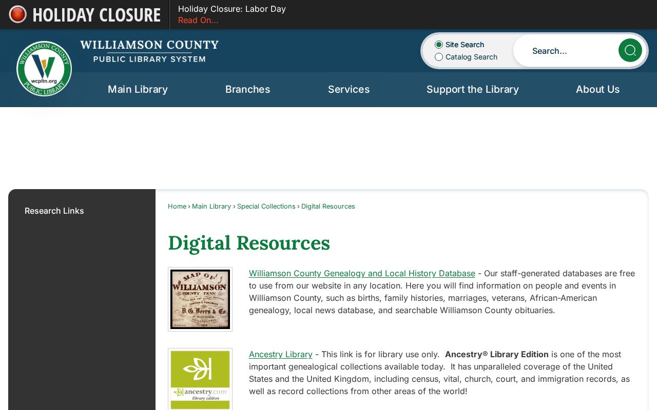
The Williamson County Public Library Digital Resources provide a local genealogy database, library-use Ancestry access, Fold3, HeritageQuest, Tennessee Electronic Library links, and FamilySearch affiliate access at named branches. These sources help locate dated notices, family histories, and historical clues, not a current block roster. A library record should retain its publication date, creator, and collection reference before it is paired with an archival or county source.
WCPL's digital-resources page shows the local research channels that can add dated context to a parcel trail.
Use a newspaper or directory lead to ask a focused question of the Archives, assessor, or deed custodian instead of presenting it as proof of current residence.
Franklin Neighbors Privacy Limits
Tennessee's Public Records Act is not a permission slip to assemble private block lists. A request should identify the record type, office, date range, and inspection or copy method. The correct custodian may redact confidential fields. Court restrictions, voter exclusions, vital-record entitlement, protected addresses, investigative records, and private association rosters remain separate limits. Safe at Home provides a substitute address for eligible participants, and a map or deed must never be used to defeat that protection.
Keep a block report narrow: layer URL, query date, parcel identifiers, adjacency relation, source date, and the precise role the record supports. Do not publish excluded identifiers, unnecessary current-address detail, or a private membership list. A false record should be corrected with the originating custodian and the relevant parcel, instrument, case, voter, or license identifier.
If a source is unavailable, record that gap instead of filling it with an assumption. The city, county, library, Archives, and state office each keep different material and can explain their own access rules. A useful Franklin neighbors note can therefore end with a custodian contact, an inspection date, or a request reference while leaving a person-to-address connection unconfirmed.
Lawful use. Franklin neighbors research is for personal, lawful community and property questions. Do not use public information to monitor, stalk, harass, threaten, or contact another person against their wishes.