
Tracing Franklin Streets by Address
A Franklin street search starts with a specific address and separates land records from evidence about a person. The county assessor is the bridge from a street number to a parcel and assessed owner. The Register of Deeds then supplies the legal transfer trail. A voter source is narrower: Tennessee’s public lookup requires an authorized match using a county, first name, last name, birth month, and birth year. It is not a public control for browsing a whole street. Historical address-first material can add dated context, but it does not convert a past entry into a current household roster.
- Write the address exactly as known, including direction, street type, unit, ZIP, subdivision, and any older spelling.
- Use the Williamson County Property Search to locate the situs, owner display, parcel description, lot, sale date, and price.
- Open the matching parcel in the city map layers and preserve the parcel identifier, geometry, street segment, and map date.
- Move the owner name or legal description into the deed index, recording the instrument, book or page reference, grantor, grantee, and prior-deed lead.
- Use an authorized voter match only when the required fields are available, then ask library staff for an address-first volume when an older household question remains.
That order is a practical criss-cross workflow: address to parcel, parcel to owner, owner to deed, then a separately authorized voter match and a dated directory check. It also leaves room for a mismatch. A street address may identify several parcels, a common area, or multiple units. Record one row for each address point and one for each parcel when the systems do not align.
Note: A street result should name its source date and state whether it reflects property, map, deed, election, or historical-directory evidence.
Normalizing Franklin Street Addresses
Franklin address research needs both the original wording and a normalized search form. Preserve the street number, directional prefix or suffix, street type, apartment or unit, subdivision, city, ZIP, parcel ID, and tax-grid or map reference from each source. Then test reasonable variants, such as Main Street and West Main Street, Avenue and Ave, numbered-street formats, historic names, and former address numbers. The property portal may use a current situs label even when an older deed uses a lot, block, subdivision, or metes-and-bounds description.
Do not silently replace an old label with a current map point. Compare deeds and plats across time, then use parcel geometry and the legal description to make a dated crosswalk. Adjacent owners, acreage, and deed calls can be more useful than a modern street label when an older record lacks a number. A complete Franklin-wide numbering formula, dated renaming list, and full annexation-to-address crosswalk were not located in the official material, so those details should not be assumed.
Franklin Street GIS Layers
The Franklin CommunityMap Atlas service exposes addresses, parcels, streets, buildings, railroads, parks, waterways, city limits, the Urban Growth Boundary, and Williamson County. These layers make a street inquiry geographic before it becomes a name search. Start at the address point or street segment, identify the parcel, and retain the query date. City limits and the Urban Growth Boundary are different polygons, even where a postal address reads Franklin.
The City of Franklin GIS service is the source for this address-and-parcel map view.
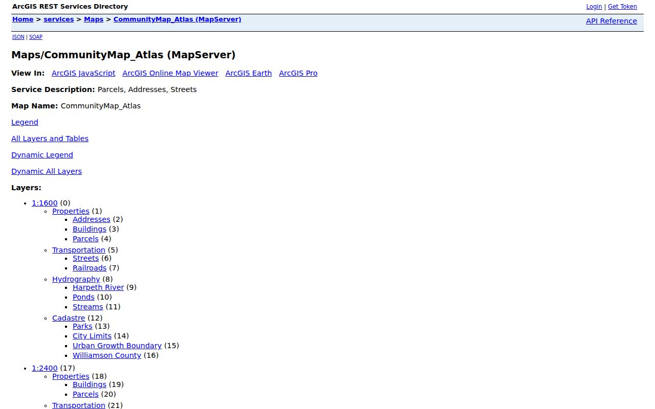
The layer set helps distinguish a mapped parcel from a building footprint, a park, a road, or a common-area tract. A visible shape is useful context, not evidence that a person occupies it.
County maps can add voting, civil-district, zoning, and traffic-shed views. Those layers answer civic or land-use questions, but none turns a ZIP, ward, or district into a legal ownership boundary. For an entire named street, work in small geographic slices and preserve the selected layer URL rather than relying on a screen view alone.
Franklin Assessor Street Fields
The Williamson County Property Assessor maintains cadastral maps, current taxpayer indexes, ownership records, tax rolls, and assessments. Its public property search accepts either an owner clue or an address clue, which makes it the most direct first stop for an address search. The visible results list owner or owners, property address, city, parcel description, lot number, sale date, and price. A selected parcel may also show mailing and situs details, map or parcel numbers, legal description, values, exemptions, acreage, and map connections.
| Assessor search field | Input | Search use | Portal note |
|---|---|---|---|
| Owner Name | Text | Find an assessed owner | Example format shown: Smith John Q |
| Property Address | Text | Find a situs address | Example shown: 123 MAIN ST |
| Subdivision | Text | Narrow a development | Use the recorded subdivision name |
| City | Select | Limit by portal city value | Options load dynamically |
| Lot Number | Text | Connect a plat clue | Pair with subdivision where possible |
| Map or Parcel | Text | Carry an identifier across systems | No single published parcel mask |
| Last sold dates | Date | Narrow by transfer period | On or after and on or before controls |
The assessor has the current assessment record, not the final word on legal title. For a plat question, deed question, or certified document, contact the Register of Deeds instead. The assessor office is at 1320 West Main Street in Franklin and can be reached at 615-790-5708. An in-person, phone, or focused records request can help when the visible search cannot resolve a parcel.
Franklin Street Situs and Mail
An address record should preserve two different address fields. Situs is the physical location of the land or improvement. Mailing is where tax or official correspondence goes. A tax mailing address may be a post-office box, a different property, an agent’s address, a former address, or an address outside Franklin. That difference can be a useful lead, but it is not proof that the mailed-to address is a residence or that the property’s owner lives at the situs.
Compare the assessor display with the most recent deed and, where lawful and relevant, a separate official record. Ownership can lag a closing; an exemption flag can support a tax classification or owner-occupancy hypothesis, but it cannot identify every person at an address. This corrects a common address-search assumption: the parcel owner, mailing contact, and current occupant may be different people.
Franklin Street Deed Cross-References
The Williamson County Professional Access route offers property data, deeds and titles, county maps, and property-tax records through a paid subscription. The Register of Deeds remains the custodian for deeds and plats. Start a current chain with the parcel number or legal description, then capture the latest deed’s grantor, grantee, execution and recording dates, consideration, book or page or instrument number, legal description, and any cited prior deed. A deed names legal parties and property, not every person at the location.
The Professional Access entry point is shown in this Franklin deed-record image.
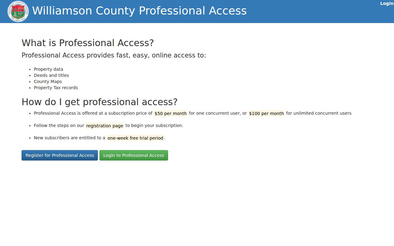
Professional Access lists a one-week free trial, then $50 per month for one concurrent user or $100 per month for unlimited concurrent users. Paid access is an image route, not a substitute for a certified copy from the county custodian.
- Parcel
- A mapped tax or land-record unit used to connect assessor and GIS data. Its identifier should be copied exactly.
- Situs address
- The physical address attached to a parcel record, kept separate from a tax-mailing address.
- Plat
- A recorded map that can show a subdivision, lot, block, easements, and rights-of-way.
- Criss-cross directory
- An address-first directory that may place a dated household or business entry under a street address.
TitleSearcher’s legal-description search supplies another paid route. Its help material allows optional name, subdivision, document type, document number, date-range, legal-description, and book or page searches. A beginning date alone searches forward; an ending date alone searches from 2000 to the selected date. Refer-backs or cross-references point to earlier documents, and “Not Indexed” can mean an instrument has not yet been verified or certified.
The TitleSearcher page shown here is a useful reminder to record search settings before opening a result.
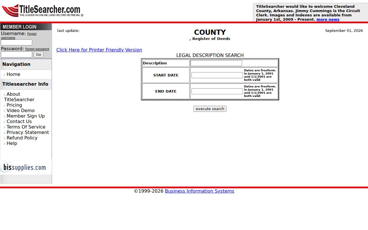
Pay-as-you-go access begins with a $5 card deposit, charges $0.25 to open a name result, and charges $2 per image. The viewer can show PDF or TIFF images. Search the grantee as an earlier owner and the grantor as the next reverse-search lead when a prior reference is missing.
Franklin Street Directory Records
No single Franklin street record supplies a complete resident list. The records below are address-keyed in different ways and should be read together without merging their limits. The assessor and map layers are current discovery tools; the Register supplies the legal instrument chain; city tools add built-environment context; the election route is a restricted individual-match or lawful-file route.
| Address-keyed source | Franklin or county keeper | Fields to retain | Access route |
|---|---|---|---|
| Assessment and property roll | Williamson County Property Assessor | Owner, situs, mailing, parcel, sale details | Free public portal; office, phone, or focused request |
| Parcel and address layers | City of Franklin GIS | Address point, geometry, GISLINK, parcel ID, zoning | Public map service; GIS contact or data request |
| Deeds and plats | Register of Deeds | Legal parties, instrument, book or page, description | Paid online route, custodian, or historical archives |
| Permits and development material | City of Franklin | Address, dates, work or development lead | Portal or date-bounded city request |
| Voter material | Tennessee and Election Commission | Authorized match or lawful-file fields | Required-field lookup or statutory request route |
| Historic address sources | WCPL and Williamson County Archives | Volume, year, page, street entry, archival reference | Library or Reading Room follow-up |
Use the source that owns the question. The Trustee handles property-tax payment and delinquency leads, while the assessor handles assessment questions and the Register handles deed and plat questions. No complete current county tax-sale or foreclosure index URL was located in the research. Ask the appropriate office for a parcel number, tax year, sale date, notice, purchaser, and redemption status instead of treating an owner search as a tax-history search.
Franklin Street Voter Match Limits
The Tennessee Voter Registration Lookup requires county, first name, last name, birth month, and birth year. Williamson County must be selected, first and last names are required, and the form’s inspected page showed a 20-character limit for each name with a two-character minimum for last name. A no-match result instructs the user to verify the information and contact the local election office. The static inspection did not expose a fixed result schema, so extra fields should be described only as live output with a date.
Tennessee registration records are public to Tennessee citizens with protected identifiers excluded, but the public lookup is not a street-browse tool. Permanent registration-record inspection is addressed by T.C.A. § 2-2-127. Computerized county or statewide lists and voter history have a separate purchase and certification route under T.C.A. § 2-2-138, including authorized political-use restrictions. Ask the Williamson County Election Commission for its current application, permitted format, payment method, and certification language before assuming a bulk output is available.
The Election Commission is at 405 Downs Boulevard, Franklin, and its phone is 615-790-5711. Do not capture or share Social Security numbers, driver-license numbers, Department of Safety identifiers, absentee-voter Social Security numbers, dates of birth, mailing addresses, or email fields that are excluded or subject to added confidentiality.
Note: A voter record can support a dated, authorized match but cannot serve as a permanent household list for a Franklin street.
Franklin Street Query Cap
The CommunityMap parcel query service supports geometry, parcel fields, offsets, sorting, and JSON, GeoJSON, or PBF responses, but its maximum record and selection count is 2,000. That ceiling matters when a Franklin street search expands from one block to a broad area. Split a large request by tax grid, street segment, geometry envelope, or another smaller parcel query. Keep the returned count, layer name, query URL, and date with the search notes.
This limit is an important practical check. A result set that stops at 2,000 is not a full street census. The City GIS contact is 615-550-6981, and the research reports digital data at $10 per layer per tax grid. For a defined map layer, address-point extract, permit, or neighborhood-registration record, a focused Tennessee Public Records Act request is more useful than asking for all records.
Franklin Street Postal Mismatches
A Franklin mailing city, municipal boundary, county boundary, subdivision, census area, tax grid, and ZIP can all describe different geography. The USPS ZIP Code Lookup is the tie-breaker for a specific deliverable address, standardized spelling, ZIP+4, and postal city line. It should not be used to prove city-limit residence. The postal ZIPs documented for Franklin mailing use are 37064, 37065, 37067, 37068, and 37069, but each address still needs address-level verification.
A Franklin postal address can sit in an unincorporated pocket, an urban-growth area, or a county parcel outside the incorporated city. A parcel inside the city may have a mailing address or ZIP that looks different from its physical location. Preserve the year and source for each postal label. This prevents a Franklin street search from treating a PO Box ZIP or a routing change as a neighborhood boundary.
Franklin Street History Checks
For an older street question, begin after 1966 at the Register of Deeds and use the Archives and Tennessee State Library and Archives microfilm for pre-1966 deed work. The Archives lists deed books at 1786, 1792–1963, and 1977; its Reading Room provides the handoff for historical material. The 1951–1966 direct and reverse indexes are identified on microfilm reels 133–136. These ranges are starting points, not proof that every historic instrument is online or that each record uses a current address.
The Williamson County Archives online index has more than 405,000 entries across historical record groups, but an index result may point to a microfilm reel, bound book, or loose file rather than a downloadable image. The Reading Room at 611 West Main Street is the follow-up route. Williamson County Library Special Collections confirms city directories, microfilm, newspapers, maps, yearbooks, and other local-history material. For an old address-first entry, ask staff to record the volume title, publisher, year, page, and street entry. The historical shelf is explored in more depth through the Franklin city directory collections.
Sanborn Insurance Maps can show downtown Franklin building footprints, uses, materials, and nearby features for mapped dates, but the local guide limits the cited coverage to Downtown Franklin. They are not a household directory. Pair a street label with a deed, plat, tax book, directory, or newspaper date before drawing a conclusion about a past address.
Franklin Street Directory Limits
A Franklin street directory cannot establish every person who lives at an address. An assessed owner is not necessarily an occupant. A deed grantor or grantee is not a household roster. A voter registration is not permanent proof of current residence, and a mapped parcel is not permission to disclose protected information. Utilities and delivery customer records should be treated as nonpublic unless a custodian identifies a lawful disclosure. City neighborhood registration provides a representative and verification process, not a public membership directory.
Under the Tennessee Public Records Act, a request should identify the custodian, record type, date range, subject, and preferred inspection or copy method. The Tennessee Open Records Counsel guidance describes inspection, phone, fax, mail, email, and portal channels. Williamson County may require identification showing a Tennessee address for a copy request. A custodian can provide a redacted record where an excluded field is confidential.
Use a county or city office, the library, the Archives, phone contact, a defined public-record request, or the paid deed portal according to the kind and date of record needed. Certified deeds and plats come from the Register of Deeds. The Register is at 1320 West Main Street, Suite 201, Franklin, is open 8:00 a.m. to 4:30 p.m., and can be reached at 615-790-5706. Record errors should be taken to the originating custodian with the relevant parcel, instrument, voter, or case identifier and documentary support.